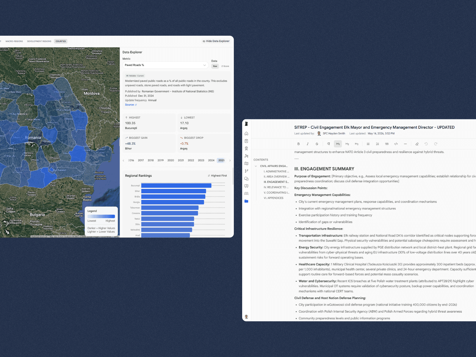
Civil data integration
Unify civil data at scale
Synthesize operator-collected data with pre-validated, authoritative sources across the PMESII-PT framework down to the lowest level of granularity.
Civil Environment Navigator brings agentic data integration and analysis to teams navigating complex civil domains — built for speed, security, and scale.
Mission
Designed by operators to reflect the full Civil Affairs workflow, from data integration to products and reporting.
Civil data integration
Synthesize operator-collected data with pre-validated, authoritative sources across the PMESII-PT framework down to the lowest level of granularity.
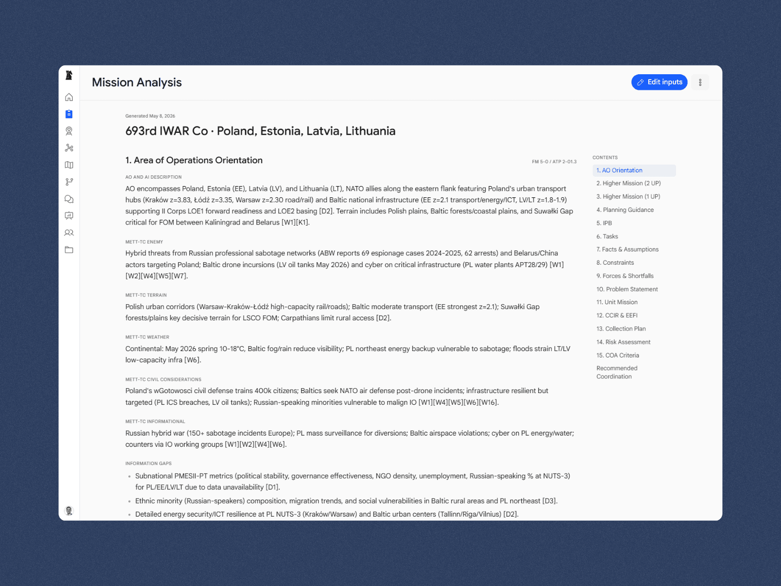
Mission analysis
Generate mission-ready analysis of the civil information environment, prodiving the frame of reference for all other modules and products.
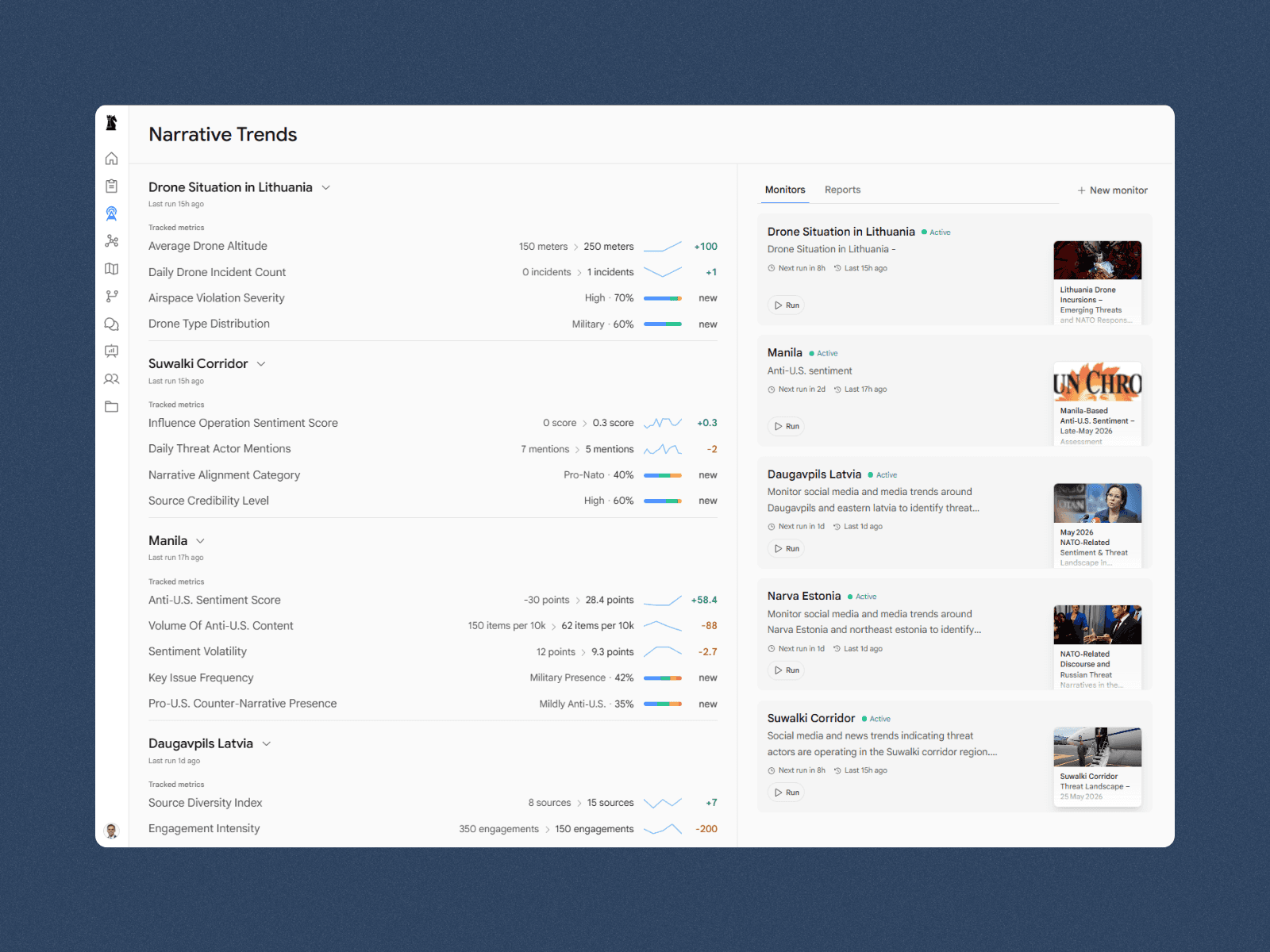
Narrative trends
Monitor emerging themes and narratives with background agents that convert open-source data into operator-defined metrics you can track in real time.
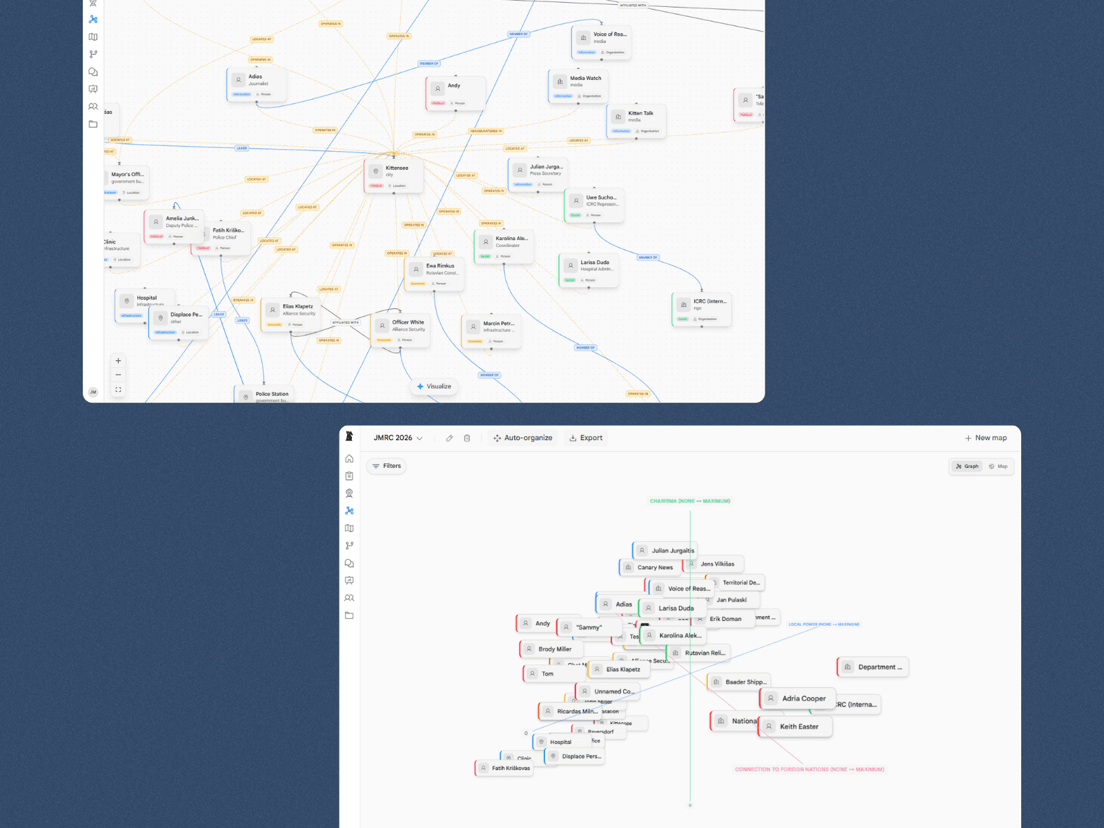
Network mapping
Reveal key actors, institutions, and influence pathways. Run automated reconnaissance to enrich nodes. Visualize hidden relationships in natural language.
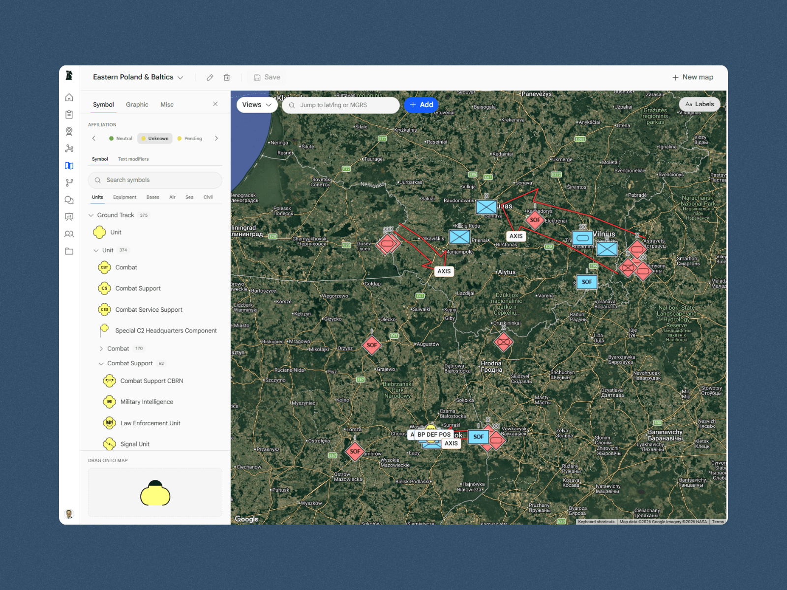
Situation maps
Leverage the full MIL-STD-2525B model to build living situation maps that reflect the current state of the mission at hand.
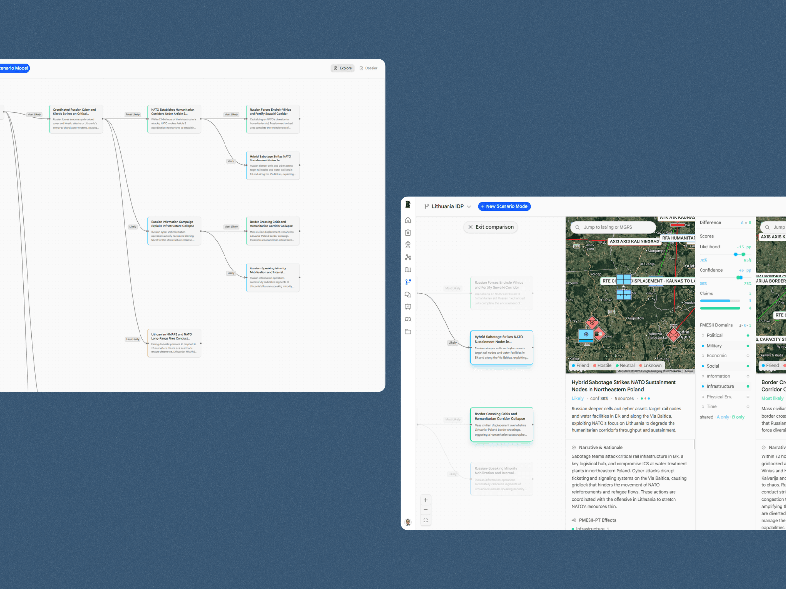
Scenario modeling
Explore second and third-order effects across civil domains. Scenario tools support planning, wargaming, and course-of-action comparison, enriched by existing knowledge from your team.
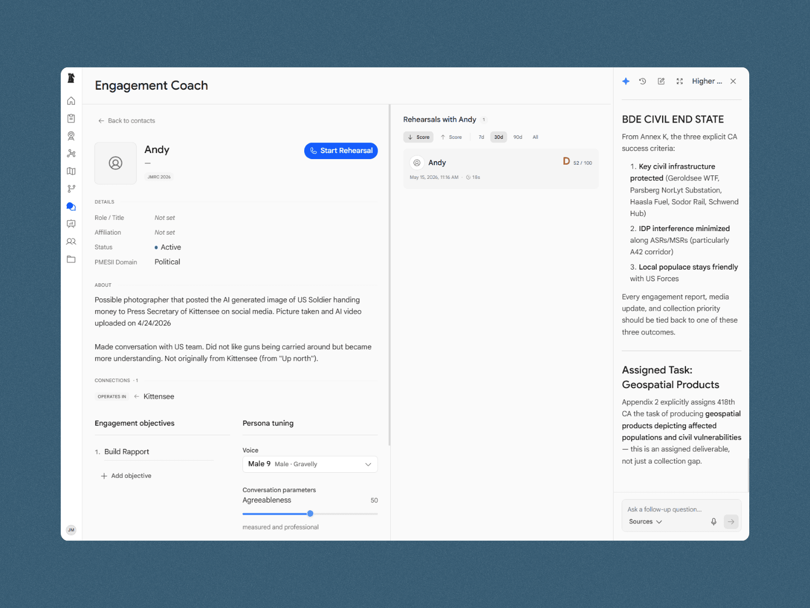
Engagement coach
Practice engagements with realistic digital twins, grade your performance, and get feedback on your approach to improve your skills.
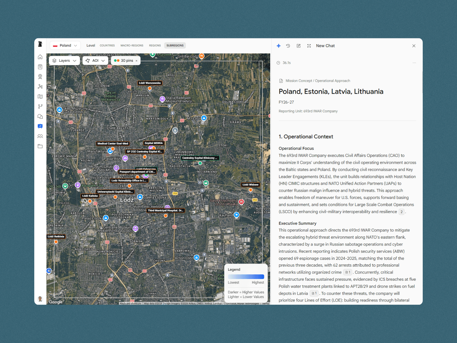
Products & reporting
Generate briefs, reports, and commander-ready products from integrated analysis in minutes, fully editable and exportable to your existing tools.